_edited.jpg)
Northwest Passage


By the time we arrived in Upernavik, we had already covered 560 nautical miles of the Northwest Passage (NWP) as of July 20. The passage is measured from the Arctic Circle and ends back at the Arctic Circle in Alaska. For us, the passage therefore lasts from June 1 to September 6, 2026 and covers 3600 NM.

We’re familiar with the small harbor in Upernavik from last year. It’s narrow, and there’s very little space for sailboats. Mostly fishing boats and cargo ships are moored there. After initially securing a spot at the only large pier and spending a rocky night there, we have to make way for the cargo ship “Vestborg” the next day. The crew, however, kindly lets us moor alongside. We climb a sturdy rope ladder to the deck of the “Vestborg” and thus make it ashore. We stock up on what will be our last supplies for the time being, refuel, and move to the nearby anchorage at Sarpinat. Here, we prepare for the next leg of our journey. Now it’s a matter of waiting for a suitable weather window. We use the waiting time to sew blackout and insulation covers for the saloon windows and to clean the hull and propeller a bit using our dry-suit diving gear. Fortunately, we run into Chris and Olga from Lausanne, who are also planning the NWP.

On July 27, the time has come, and we set out onto the open sea toward Canada under calm conditions and sunny skies. After 30 nautical miles, a light southeasterly wind picks up. At first, we motor-sail. Soon we’re cruising comfortably (4–5.5 knots) under full sail with a broad reach. On the fifth day, a strong wind blows in our faces, and we make good progress thanks to our reefed sails. We pass four glacier tongues flowing into the sea. The water here is greenish. With good visibility, we reach Dundas Harbor on Devon Island. Slowly, we have to say goodbye to the icebergs, which become increasingly rare from here on. After a good four days and just under 500 NM, we’ve completed the first leg. Via Marine Traffic, we spot other sailboats and motor yachts (about 12) for the first time—they’re likely also heading for the Northwest Passage. Most are sailing via Pond Inlet to register in Canada. We were able to do that online in advance. However, as we later learned, many people aren’t yet aware of this new option.

We have now reached the northernmost point of our journey in Canada, at 74° N. Devon Island is 34% larger than Switzerland. The island is unmistakably defined by Arctic tundra, an ice cap on the plateau mountains, and a complete absence of human habitation. At our first anchorages, Dundas Harbor and Burnett Inlet, we find hardly any ice, but this is expected to change after 50 NM. We are monitoring the ice conditions in Peel Sound and Prince Regent Sound. The Norwegian ship Alma af Frøya was the first sailing vessel to cross the Parry Channel and enter Peel Sound. We know the ideal conditions there. Most yachts are attempting to reach Franklin Strait via Bellot Strait. However, this narrow waterway is not yet ice-free and therefore not safe to navigate. We seize the opportunity to head further west earlier than planned and cross the ice zone above Peel Sound.

Departure is definitely set for August 5! It’s a real pleasure that our new sailing friends, Chris and Olga on the SY Blue Peter, have also chosen the Peel Sound. In the Parry Channel, we sail through an open drift ice zone. With excellent visibility, it’s no problem. In the Peel Sound, we make good sailing progress. The Bellot Strait becomes navigable shortly afterward. Other sailors and the first cruise ships follow.

At the point where we must decide whether to head toward Victoria Strait or continue on to Gjøa, the ice charts show a zone with a 5/10 ice concentration. The ice extends directly across our route, which lies within this poorly charted area. We therefore decide to head for Gjøa. The landscape toward Gjøa is characterized by very flat, desert-like strips of islands. The water is very shallow but, fortunately, very well charted. With sunshine and a favorable current, we glide through the James Ross Strait.

After 530 nautical miles, we reach Gjøa Havn. Amundsen and his crew spent the winters there in 1902 and 1903. Here we meet the Alma af Frøja, which is following Amundsen's route. The people in Gjøa are open and very friendly. On Sunday evening, we will take in the lively little town from the Aegir. The temperature is 16 degrees. Children are playing and fishing on the beach. Young men ride their ATVs, motorcycles and even snowmobiles across the sandy trails. We set sail again the very next day since we still had many nautical miles ahead of us.


We sailed through the narrow Simpson Strait with its strong current at a speed of 3 knots. Our broad reach ensures good progress. We are now sailing on to Cambridge Bay. We should have stopped at Jenny Lind Island. Nevertheless, we press on. Northwest winds are coming in. They will make progress and the ice conditions will worsen as we head west from Amundsen Gulf. The sun has been setting again for a few days now. We are not comfortable with the idea of sailing through icy waters at night again so soon.
In Cambridge Bay, we're moored next to the SY Aglaia at the dock. The skipper is Kirsten Neuschäfer. She won the Golden Globe in 2022. She is sailing the boat to Seattle for the owner. Two crew members from the SY Lifexplorer stop by to visit us. The Lifexplorer and another sailboat made their way through the thick ice off Alaska very early on. They are expected here in the next few days and will then sail on to Aasiaat in Greenland. They are going to overwinter the boat there.

We order the diesel truck and restock our supplies. On we go! The sea is as smooth as glass, with only a few current zones to disrupt it. We stop at Disappointment Harbor on Edinburgh Island. Our Aegir gets a rain shower, and we turn our attention to our graywater pump. The pump is not draining properly. We've replaced the seals, but it continues to function only partially until it finally gives out completely. A hand pump is essential to prevent overflow. We'll have to wait until we reach Nome to repair it.


The sailing yachts Aglaia, Hafiz and Vanuily have also set sail from Cambridge Bay. A meeting is imminent. On 15 August, we encountered the first oncoming vessel: the SY Lifexplorer, flying the Swiss flag and a fellow OOC member, was the first sailboat to arrive from Alaska this year. It passes very close to us, and we cheer to one another—what a joy! It is clear that they still have the more relaxed stretch to Greenland, Aasiaat ahead of them.


Our destination is Parry Peninsula. We are heading straight for Summers Harbor, but an approaching storm in the coming days and the northern ice force us to change our plans. We decided to head for Letty Harbor with the SY Blue Peter. With sunshine and a light tailwind, we deploy our parasail and find the best route through the strong current in Amundsen Gulf. As we make our way to our anchorage, we pass through a small ice zone (1/10), clearly visible on the radar images in the SIKU app.

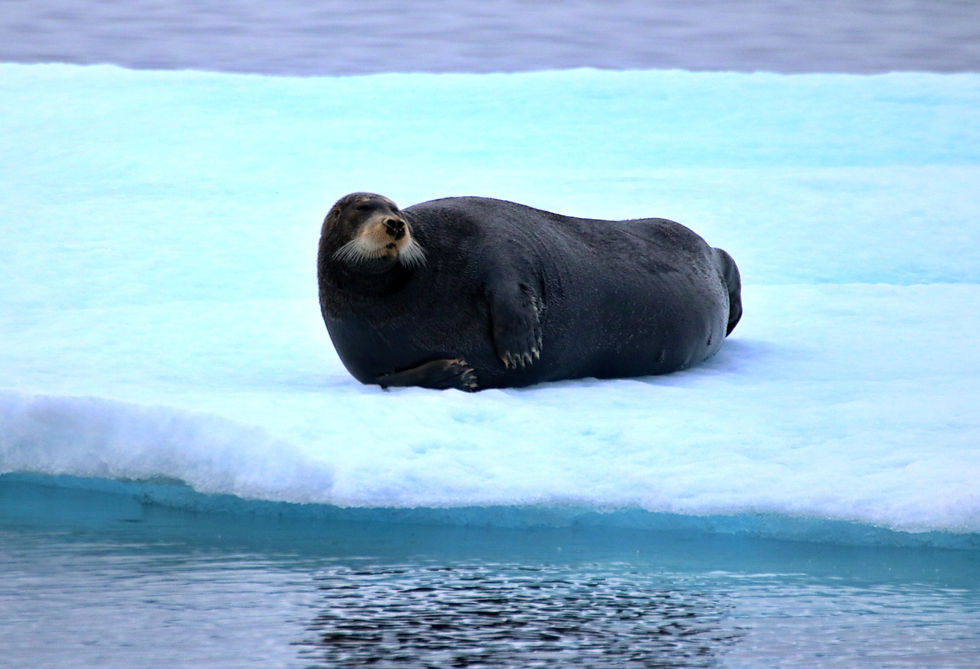
Letty Harbor is a very sheltered and shallow bay. Our draft is 2.25 m, so we always feel a bit uneasy sailing in shallow waters. We check the depths with the dinghy and a handheld echo sounder, then drop anchor. The wind shifted the next day, and we are now moored with the stern closer to shore. Now is the time to reset the anchor and lay out two shore lines (bow and stern). The forecast strong winds won't bother us after that. We had a great evening with Chris and Olga. Olga treats us to an excellent four-course meal, accompanied by our last bottle of white wine from Nova Scotia and a fine French wine. We discuss the rest of our journey. The ice conditions have changed with the northwest wind. We're staying in the bay one more day. Seals are clearly swimming around our boats, which is a definitive sign of fish. It is clear that in this weather, no one wants to go out fishing.

Next, we head straight for Summers Harbor. Old and new ice, floes of various sizes, and growlers and bergy bits cover the water. From here on, the ice will be with us for 14 days until we reach Thetis Island in Alaska. We receive first-rate ice information and tips from Victor Wejer. Since 2006, he has been the go-to person for sailors, providing them with vital information and assessments on ice and weather, and guiding them through the NWP. We also obtain ice and weather data online from Canadian services and the NOAA. Our route planning is clear: the route runs mostly very close to the coast. The nighttime legs through Amundsen Gulf and from Herschel Island to the Canadian-American border at Demarcation Point are extremely stressful. Sailing along an ice edge, as in Amundsen Gulf, is still manageable. On the way to Demarcation Point, however, we hit ice and the radar is mostly red. At one point, we have to slow down and back up to avoid a huge ice floe. We got lucky! I, Christine, am in the bow with the handheld spotlight, guiding us through the ice.

We stop in Tuk for one night to refuel and then continue sailing directly from there. On Herschel Island, we meet in person with the crews of the Hafiz, Vanuily, and Aglaia. We exchange contact information, which proves very helpful for the rest of the journey. Unfortunately, there is no ranger on site who can grant us permission to use the sauna. Entering the U.S. (Alaska) is straightforward. We register via the CBP Roam app, designating Nome as our "port of entry," and our entry is confirmed. We reach Demarcation Bay at 4 a.m., feeling quite exhausted. After two hours of sleep, we lift anchor at daybreak. We know that the denser ice on the stretch to Kaktovik will still be very close to the coast. Beyond Kaktovik, the ice density decreases rapidly and the ice edge is much farther away.


The next anchorage in the open Simsons Bay has two sides to it. On the one hand, a nasty swell barely lets us sleep, and on the other, we’re treated to a wonderful panorama of the snow-capped, towering Franklin Mountains. The positives far outweigh the negatives. We enjoy this view in glorious weather. The next morning, the mountains glow as the sun rises. Beyond Brownlow Point lie many small, mostly shallow islands – or headlands, to be precise. To the north, there's still a lot of ice, which is why we're taking the inner route through Newport Entrance. The nautical charts are inaccurate and the shallow water is stressful. At the entrance, there is 50 cm of water under the keel. After that, the route continues through shallow, stress-free, ice-free waters all the way to Harrison Bay/Thetis Island. The anchorage lies behind a crescent-shaped headland, offering perfect protection from the swell.
We will stay overnight with the three other boats. We are now free to proceed with our voyage, knowing that the risk of further ice travel has been eliminated. However, concern about more very poor anchorages all the way to Nome and the corresponding route planning has arisen, given the strong winds that are coming. Point Barrow is the northernmost point of the United States. Elson Lagoon is formed by a narrow, shallow headland.

Navigation is extremely challenging. The charts show that, given our draft, we can only anchor right at the entrance to the lagoon. The approach is constantly changing due to the exposed location. Ice and surf alter the headlands and the seabed just offshore. The SY Aglaia has the same draft restriction as we do and is anchored a few hours ahead of us at the entrance. They have explored the entrance and the lagoon with their dinghy and a handheld echo sounder. Their data allowed us to sail into the lagoon "relatively relaxed" and anchor right behind the end of the headland, next to them. Our anchor holds immediately, so we are confident about the strong winds ahead. We keep an anchor watch overnight.


We are monitoring the approaching low-pressure system to ensure we are ready to continue our journey at the right moment. It will take us two days to reach Point Hope and four days to Nome. We know that northerly winds are perfect for sailing as we head down the coast, but we also know about the strong northerly current in the Chukchi Sea. This combination will undoubtedly lead to rough waves. We are confident that an easterly wind will arrive after 3.5 days in Elson Lagoon. As we leave the northernmost town in the U.S., the ice and the Beaufort Sea behind, two polar bears appear on the nearby headland. We watch them for hours as they play and search for food. We are launching our dinghy again, which is a bit nerve-wracking because of the unexpected visitors. Fortunately, they don't take any notice of us and aren't bothered by our presence.

On September 3, we leave the Beaufort Sea and sail directly to Nome. Here, we get a taste of what the Chukchi Sea has to offer. We make our way along the coast under engine power, battling the strong northward current. Expect strong winds from the east after a day. We are well reefed and sailing towards Cape Lisburne, where gusts of up to 42 knots are expected. The waves in this shallow area are up to 4 metres high and, unfortunately, also very steep due to the 20-metre shallow water depth. Point Hope is the end of the wild ride. We pressed on and slept a little better when off watch. On 6 September, we will cross the Arctic Circle and officially complete the Northwest Passage after 3,600 nautical miles. On the way to Nome, we sail just past the Diomede Islands. One half belongs to the U.S., the other to Russia. Only 4 km separate these two islands, and the International Date Line runs right through them.
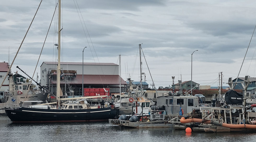

We're celebrating our arrival in Nome, and we're doing it in style! We made it here. We can say with confidence that the NWP is fantastic. We absolutely made the right decision to set aside so much time for Greenland beforehand. During the crossing, the motto was: Keep going. The crossing was undoubtedly a real highlight, especially the landscape in northern Alaska with the Franklin Mountains. We saw polar bears! The list of animals is long and there's always something new to discover: seals, whales, walruses, musk oxen and various birds. We navigated the ice conditions as a team, had minimal contact with the ice, and will inspect the damage to the hull during our next haul-out. We were thrilled to be so close to the pack ice. The NWP was part of our journey this year, and we are not yet finished. We have 1,250 nautical miles to go to Seward. We're leaving the ship there for the winter.


Comments